GIS mapping giant Esri partners with Microsoft on Azure, AI technologies
![]() 2 min. read
2 min. read
![]() Published on
Published on
Share this article

Read our disclosure page to find out how can you help Windows Report sustain the editorial team Read more
Microsoft has partnered up with Esri, a company that’s made its name on GIS (Geographic Information Systems) mapping, to create a “newly aligned grant process.” The new process hopes to make GIS technologies more accessible to the organizations that need them, and marries together Esri and Microsoft’s work in a way that makes both of them more effective.
Esri & @Microsoft_Green join forces to accelerate conservation w/ enhanced land cover mapping #Tech https://t.co/XL74A9GpdM #AIforEarth #GIS pic.twitter.com/8Raru11wfn
— Esri (@Esri) July 12, 2017
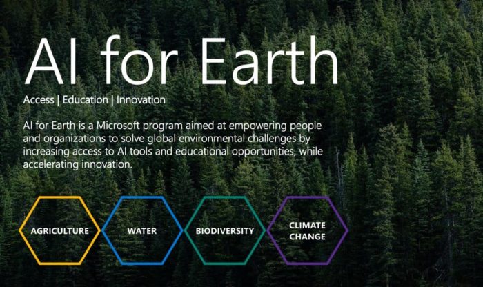
Esri’s involvement with Microsoft is part of the “AI for Earth” project, and should be helping conservationists make decisions faster and more accurately than they ever could before. Esri’s data paired with Microsoft’s technology with Azure has the potential to be a serious force for good in the attempt to go green.
“Spatial analytics is a crucial part of conservation, because it is an inherently geographic field,” said Jack Dangermond, Esri founder and president. “Understanding environmental data in the context of location is necessary when making decisions about protecting fragile ecosystems. The ability to analyze the vast quantities of data present in our environment is critical, and this collaboration allows conservationists to do their job more accurately than ever before on a wider scale.”
The partnership is part of Microsoft’s strategy to utilize artificial intelligence in more humanitarian efforts. In the words of Lucas Joppa, Microsoft’s chief environmental scientist, “We believe that human ingenuity and AI can pair together to tackle some of our biggest societal challenges – including managing climate, water, agriculture, and biodiversity resources. We’re excited to work with Esri to deliver AI technology to researchers and organizations that will help them address these challenges.”