Apple is using backpacks to collect map data in San Francisco
It's using a Google-like strategy to collect more accurate info.

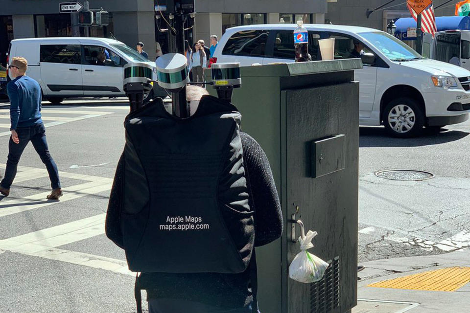
Apple's quest to improve Maps' accuracy appears to include some on-foot action. Former Engadget writer Dante Cesa has posted photos of an Apple Maps worker carrying a backpack loaded with cameras, LiDAR sensors and other equipment as he walked through San Francisco. It's not certain what the exact goal was, but MacRumors speculated that he was collecting details for pedestrian directions.
There's certainly precedent for it. Google has spent years using Street View Trekkers and similar gear to collect imagery and data for areas where cars either provide incomplete information or simply aren't an option. This could ensure that Maps points you to pedestrian-only paths more often, or that it knows just which crosswalks to take.

Apple started offering enhanced map detail with iOS 12, but you may not see the on-foot info for a while. The company's overall map upgrade is only poised to cover northern California by the fall, and it's not certain that this will include backpack data. Nonetheless, it won't be surprising if Maps is soon more trustworthy when you're content to walk where you're going.
Hello Apple Maps guy. pic.twitter.com/CoBt8iT346
— Dante Cesa (@dantecesa) October 12, 2018
