Google Maps will show you earthquake epicenters and crisis navigation
The search giant wants Maps to be a go-to information hub during a natural disaster.


Google Maps is making updates to "SOS alerts."
Google wants to make it easier to find information during a crisis or natural disaster.
Google Maps will show you information about earthquakes.
The search giant on Thursday announced new features for "SOS alerts" on Google Maps . The app already lets you see basic information about a crisis, like what's happening, emergency phone numbers and Twitter updates from authorities.
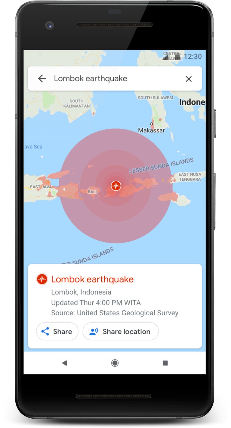
But now you'll be able to get more visual information. For example, during a hurricane, you'll be able to see the storm's trajectory and get information about what to do. In an earthquake, you'll see a graphic that tells you the epicenter and magnitude. In a flood, you'll see where the water is likely headed.
If you're in navigation mode, Google said it'll alert you if your route is affected by a disaster. You'll also be able to share your location and see road closures. The new navigation tools are coming this summer, Google said.
The new features are part of a push to make Maps a more useful hub of information beyond just looking up directions. Last month Google Maps said it would highlight a menu's most popular dishes and let people order food directly from the app.
Google also last year announced features to make the app more social, such as a "for you" tab that offers tailored recommendations and a "match score" to tell you how much you might like a restaurant or business.